![]() Bridging the Digital Divide in the CNMI!
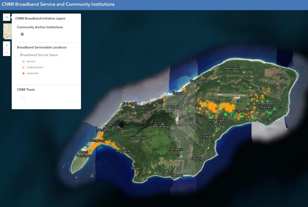
Bridging the Digital Divide in the CNMI! ![]() We’ve launched our first-ever Broadband Serviceable Locations (BSL) Map!
We’ve launched our first-ever Broadband Serviceable Locations (BSL) Map! ![]() This interactive map highlights all locations in the Northern Mariana Islands eligible for BEAD funding to boost reliable, high-speed internet access. It also shows the current broadband service status of each location. View the pictures below for a sneak-peek at our BSL Map!
This interactive map highlights all locations in the Northern Mariana Islands eligible for BEAD funding to boost reliable, high-speed internet access. It also shows the current broadband service status of each location. View the pictures below for a sneak-peek at our BSL Map!
Access the map here:
https://pcrp.maps.arcgis.com/apps/instant/basic/index.html?appid=f176f69f4db94ea698fe74600bba5152¢er=145.773;15.2547&level=14
![]() High-speed internet is vital for our community’s growth
High-speed internet is vital for our community’s growth ![]() , providing better opportunities for education
, providing better opportunities for education ![]() , healthcare
, healthcare ![]() , and economic development
, and economic development ![]() . This map is a key step towards ensuring we can stay connected
. This map is a key step towards ensuring we can stay connected ![]() . A big thank you to Pacific Coastal Research & Planning for their support in creating this essential tool!
. A big thank you to Pacific Coastal Research & Planning for their support in creating this essential tool! ![]()
If you have any questions or suggestions for our new BSL Map, please reach out to us at cnmi.bpd@gmail.com. ![]()
#DigitalEquity #HighSpeedInternet #cnmibroadband